


Open Data for Rural Road Infrastructure in Guatemala
Posted by Thalía Alondra Peña Hernández, Céline Jacquin, Belen Soria Campos • Nov. 2, 2026
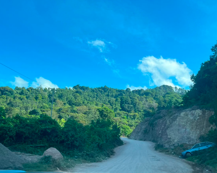
In the Jalapa Mountains, in eastern Guatemala, rural roads connect communities to schools, health centers, markets, and the main road network. They also facilitate the transport of crops such as corn, beans, and coffee, the pillars of the local economy. However, parts of this network are in poor condition, and the available information regarding their routes, surface types, and passability is either incomplete or outdated.
This gap affects rural road infrastructure planning in Guatemala. If a road’s length, continuity, or classification is recorded incorrectly, it becomes difficult to assess the feasibility of an intervention, determine the necessary machinery, or identify which communities would benefit. Furthermore, it limits the ability to document and verify the reasons for prioritizing a specific road, its condition prior to any work, and the changes that result from an intervention.
To address this challenge, the Humanitarian OpenStreetMap Team (HOT), the GT Data Lab at Rafael Landívar University, the Departmental Government of the municipality of Jalapa, and the Guatemalan Army Corps of Engineers developed a collaborative mapping process in the municipalities of Jalapa and Mataquescuintla, funded by a donation from SoftwareOne, as part of its charitable giving program.
The project built upon a previous collaborative mapping effort, spearheaded by HOT and the UNDP, to strengthen the road mapping of Guatemala. Through a national "mapathon," hundreds of volunteers contributed to adding and improving roads in OpenStreetMap, creating a dataset that later supported the planning of the *Rutas para el Desarrollo* (Routes for Development) program.
Building on this foundation, the project in Jalapa and Mataquescuintla deepened the analysis through a process that combined remote mapping, socioeconomic analysis, and on-the-ground verification. Using MapSwipe, 147 volunteers reviewed 116 km² by swiping through satellite imagery to identify areas where roads or tracks might exist. Following this review, a distributed mapping project was set up in the HOT Tasking Manager, through which 312 km of roads were mapped in OpenStreetMap.
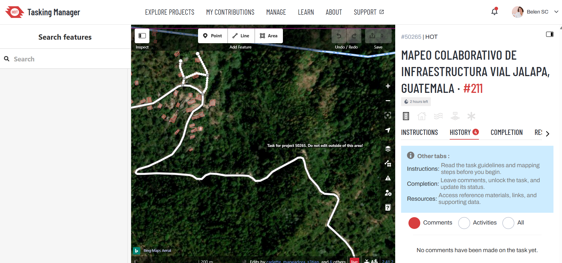
Roads traced over satellite imagery in HOT's Tasking Manager as part of a collaborative road infrastructure mapping project in Jalapa, Guatemala.
Remote mapping helped expand the information available regarding the road network; however, satellite imagery alone cannot determine whether a road is passable, whether it remains a continuous route for vehicles, or whether it meets the criteria for potential intervention. Consequently, cartographic data was combined with socioeconomic indicators to prioritize which roads to analyze, and this was subsequently verified on the ground through field surveys. In this way, approximately 180 km of rural roads were documented with greater precision by creating street-level views, known as "Street Views", on the Mapillary platform, providing visual evidence to review and refine the existing data.
This evidence was then incorporated back into the map: the specific characteristics of these roads were examined by comparing the Mapillary data with OpenStreetMap, and the classifications, attributes, and geometries were added to this public database to more accurately reflect the conditions observed in the field.
From data to the prioritization of paths
To focus the analysis, one of the primary inputs used was the Unmet Basic Needs (UBN) index, employed by Rutas para el Desarrollo as a benchmark to identify communities with the greatest deficiencies in essential services, such as water, sanitation, electricity, education, and healthcare.
This socioeconomic data was cross-referenced with road mapping, made available through a previous "mapathon" (conducted by HOT and UNDP), to identify road segments with the potential to connect high-need communities to the main road network, and thereby to essential services. Based on this analysis, a preliminary selection of 200 rural road segments, totaling 152 km, was made.
This selection was merely the starting point. To determine whether those paths actually continued as traversable routes and whether their conditions matched what was depicted on the maps, it was necessary to go out into the field.
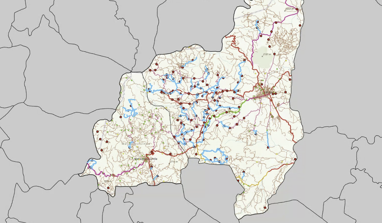
Paths reprioritized and refined based on information gathered during field verifications.
Capacity building
In preparation for field data collection, the project strengthened the capacities of public institutions, civil engineers, technical staff, and the university community in the use of tools for documenting road conditions. Fifteen engineers and officials completed an initial phase of training in Mapillary; eight conducted data-capture tests using motorcycles and other vehicles; and eight students from Rafael Landívar University practiced collecting imagery from a car. These activities familiarized participants with capturing georeferenced imagery and characterizing roads, while also helping to identify necessary adjustments for working on rural roads.
Mobile device setup for image capture during vehicle trips.
These capabilities extend beyond the data collection carried out during the project. The equipment and accessories acquired remain available to the implementing partner, with the aim of supporting ongoing documentation and monitoring activities within this national program for the improvement and connectivity of road infrastructure.
“Under this framework, the data lab could continue supporting the Rural Roads Program in new territories.”— Carlos A. Duarte
This experience also leaves behind established capabilities that will allow the work to continue. The GT Data Laboratory strengthened its expertise in supporting processes for the capture, quality control, and integration of geospatial information, training the student community to serve as a technical arm for a national essential infrastructure program. Meanwhile, the equipment and accessories acquired remain available for future documentation and monitoring activities across a broader range of topics.
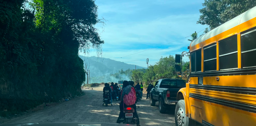
Traffic and mobility conditions observed during road network verification surveys in Jalapa, Guatemala.
Verify before intervening, and ensure transparency
As part of the verification and characterization of the prioritized roads, personnel from the Army Corps of Engineers and the Departmental Government conducted site visits along the proposed segments. Subsequently, the technical team carried out additional assessments to conduct a more in-depth review, utilizing photographs and georeferenced sequences via Mapillary, made possible through the support of this pilot project.
The fieldwork demonstrated why it is essential to cross-reference maps with ground-level reality. Some roads ended sooner than depicted; others continued only as footpaths or non-vehicular trails; and some presented obstacles that hindered access for vehicles and machinery. Furthermore, the team identified segments that were already receiving municipal maintenance, as well as others whose inclusion in the project required re-evaluation.
This distinction matters when maps guide decisions regarding public investment. A lack of awareness regarding these conditions could lead to budgetary overestimation and an allocation of resources that might overlook other areas in need, thereby complicating accountability. Collecting data in the field, with the support of an academic community that can be mobilized nationwide, enables both the government and society to verify the conditions on the ground, while creating a verifiable record of the situation in the territory. In programs of this scale, particularly in countries where the population has historically mistrusted its government, it is essential to demonstrate that actual infrastructure is being developed to address specific, identified needs.
The evidence gathered not only helped refine the initial selection but also improved the data published on OpenStreetMap, which is now accessible to any organization. The review focused, in particular, on verifying whether the classification of each road aligned with its observed condition and passability. Where the evidence allowed, other attributes, such as surface type, passability, and the number of lanes, were updated, and the alignment of certain roads was adjusted.
The result is an open representation of the road network that more accurately reflects conditions documented in the field, while simultaneously providing an evidence base that makes the planning and monitoring process for future interventions more transparent and traceable.
What changes when data is open
Open data does not replace institutional knowledge or fieldwork; rather, it connects them. It enables the integrated analysis of socioeconomic information, cartography, local expertise, and visual evidence.
The experience in Jalapa and Mataquescuintla demonstrates how this process can evolve, from remote mapping to field verification, and back to the map. 147 volunteers reviewed 116 km² using MapSwipe; 312 km of roads were mapped via the HOT Tasking Manager; territorial analysis allowed for the preliminary prioritization of 200 segments (totaling 152 km); and 180 km were documented using Mapillary. The evidence gathered facilitated the review of rural roads, improved their representation in OpenStreetMap, and helped make investments more precise, efficient, and transparent.
Beyond producing a static map, the project created an open, verifiable information base that can support the review of prioritized roads, the planning of future interventions, and subsequent monitoring. Furthermore, the visual evidence provides a baseline of the territory’s initial conditions, strengthening the traceability of both decisions and infrastructure projects.
Thanks to the efforts of the Laboratorio de Datos GT at Rafael Landívar University, the Departmental Government of Jalapa, the Army Corps of Engineers, students, technical staff, and volunteers, with guidance from HOT and support from SoftwareOne, this initiative has left behind not only updated road data but also new capabilities, tools, and a methodology that can be adapted for other regions.
Share